Kilauea Volcano June 27th Eruption: Pele’s Beautiful River of Fire
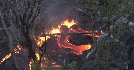
Kilauea started erupting again on June 27th creating a lava flow towards the ocean in a north -eastern direction. On September 17th the lava flow advanced at an average rate of 215 m/day (705 ft/day) between Sept 10 and Sept 12. The flow front is at about 9.6 miles from the vent. The eruption releases sulfur dioxide gas that is subject to be blown by the most predominant winds, the trade winds.
The flow is approximately 3 miles away from highway 130 connecting Hilo to Kapoho. Two alternate routes are being developed at this time to go around the flow respectively south and north of Pahoa. The flow does not present any threat to any of our locations or to any other residential area. The trade winds blow the plumes away from Kapoho, our most easterly location and access to that location will be maintained should the lava flow cut highway 130. The flow is visible by helicopter only and the plumes are visible from several areas in Puna.

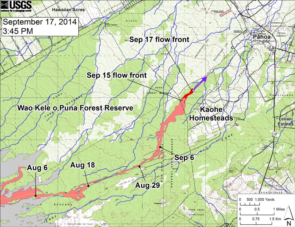
USGS HVO: “This large-scale map shows the distal part of the June 27th flow in relation to nearby Puna communities. The black dots mark the flow front on specific dates. The latitude and longitude of the flow front on September 17 was 19.4737016 /-154.977834 (Decimal degrees; WGS84). The blue lines show down-slope paths calculated from a 1983 digital elevation model (DEM; for calculation details, see http://pubs.usgs.gov/of/2007/1264/). Down-slope path analysis is based on the assumption that the digital elevation model (DEM) perfectly represents the earth’s surface. But, DEMs are not perfect, so the blue lines on this map indicate approximate flow path directions. The purple arrow shows a short term projection of flow direction based on the flow behavior over the past several days and the local topography.”

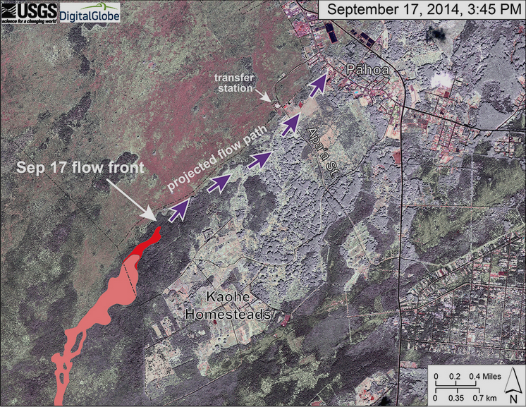
USGS HVO: “This map uses a satellite image acquired in March 2014 as a base image to show the area around the front of the June 27th lava flow. The purple arrows show the projected path of the flow over the coming two weeks, based on the current flow activity and local topography. Lava flow behavior is complex and this projection is subject to change. Satellite image provided by Digital Globe. “


